Email Us

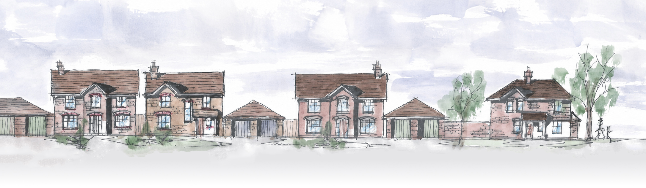
Back Lane, Whittington
Welcome to the Maplevale and Elford Homes community consultation relating to a forthcoming Outline Planning Application for land North of Back Lane, Whittington. The consultation is open from 8 September until 23:00 on 22 September 2026, and this is an opportunity to learn about the proposal, the developer, technical work undertaken and to be undertaken, and the planning timeline.
This consultation provides an opportunity to provide feedback to the development team prior to a formal planning submission to Lichfield District Council.
The proposal will deliver new market and affordable homes in a sustainable location, set within a residential area of the village and within walking distance of local services and facilities.
The project team will consider any comments made during the consultation before a formal planning submission and make appropriate amendments based on the community’s response. The consultation process and feedback will be set out in a Statement of Community Involvement submitted as part of the planning submission.
Providing feedback to this community consultation does not prevent you from commenting on the formal planning application once it is lodged with the local planning authority.

Maplevale is a local independent housebuilder, focusing on high-quality architecture and materials. Established some 20 years ago, Maplevale has grown from a small family-owned company to one of the most successful builders of new homes and developments in the Midlands.
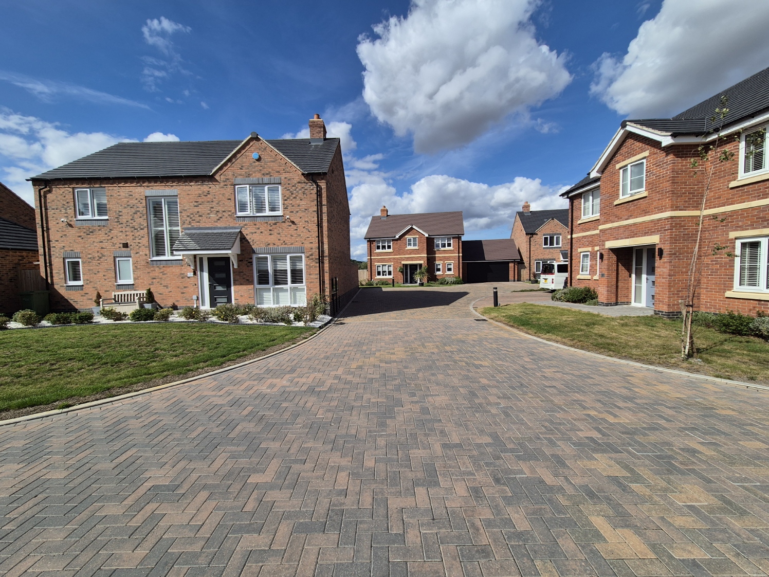
Maplevale have delivered some 800 homes in the last 10 years in both urban and rural locations, including Burton upon Trent, Tamworth, Swadlincote, Hill Ridware, Austrey, Rosliston and Repton. These developments have also secured the delivery of affordable houses in partnership with Trent and Dove Housing.
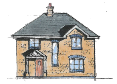
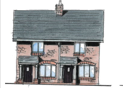
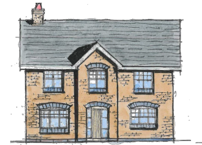
The images show examples of Maplevale’s previous work, with variation in design and house types.
The Site
The Site comprises approximately 2 hectares (approximately 5 acres) of land north of Back Lane, Whittington, with an established residential area to the south and countryside to the north.
The Site forms a single parcel of land, set off Back Lane, with good visibility to the east and west. The land sits directly adjacent to existing residential development and within walking and cycling distance of local amenities and services, including the church, shops, community centres, Whittington Primary School, and public houses.
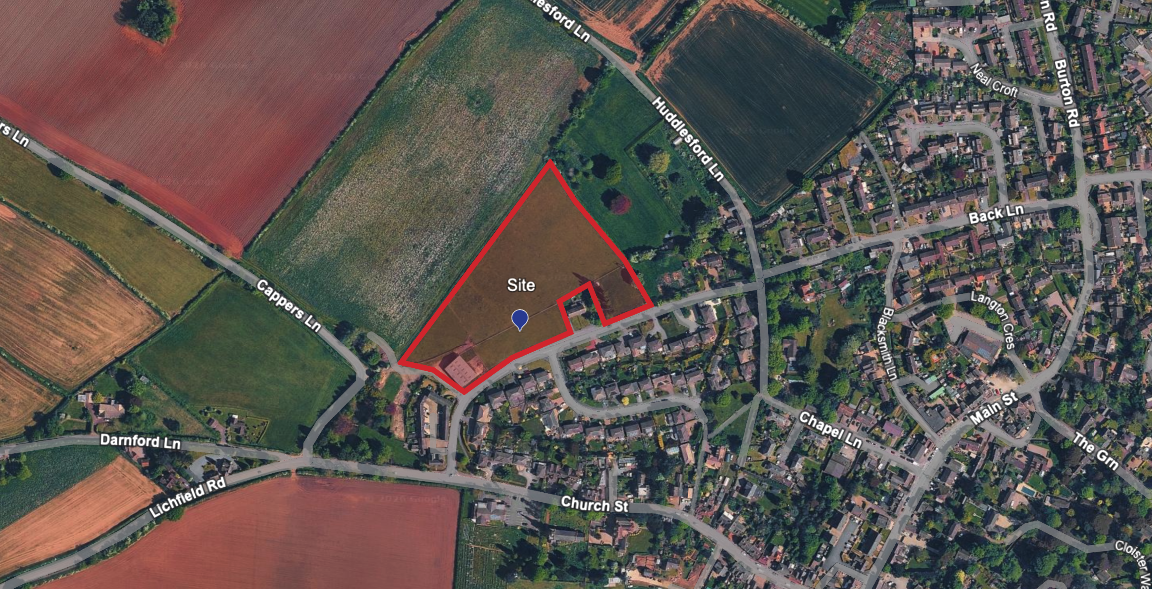
The Site is located within flood zone 1, an area with the lowest likelihood of flooding and appropriate for residential development. A review of drainage and flood risk will be undertaken as part of a formal planning application.
The Public Right of Way (PROW) crosses through the proposal site, entering from the east, intercepting the site through the central axis and exiting to the west, continuing to Cappers Lane.
The Site borders the Whittington Conservation Area and the proposal Site includes no designated built heritage assets. Heritage assets are nearby to the Site and consideration to these, and the conservation area, will be presented in the formal planning submission.
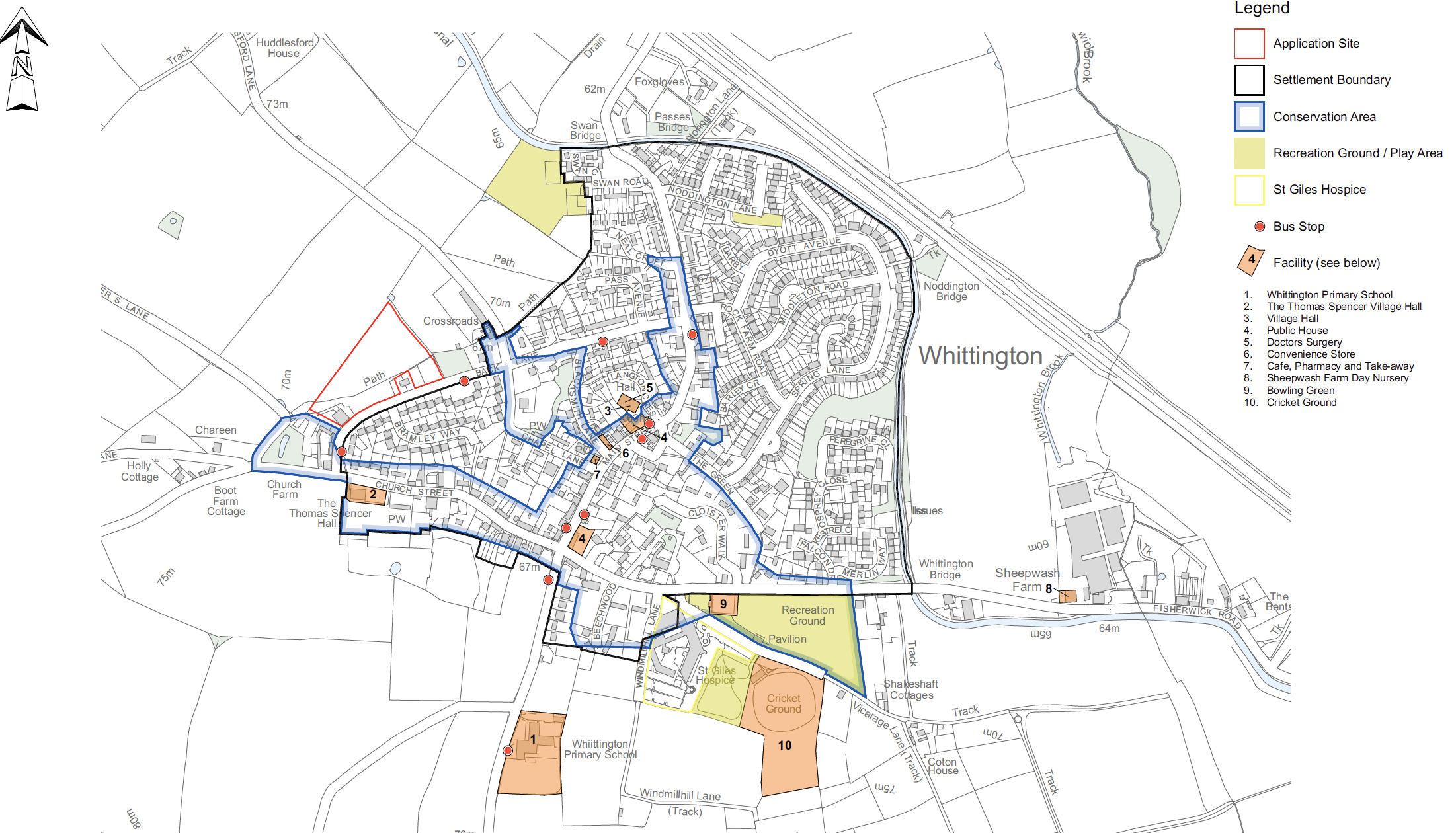
Whittington is well served for sports provision and access to open space, with a concentration of recreation facilities set off Fisherwick Road at Vicarage Lane. The local facilities within the village are presented in the image below.
The Proposal
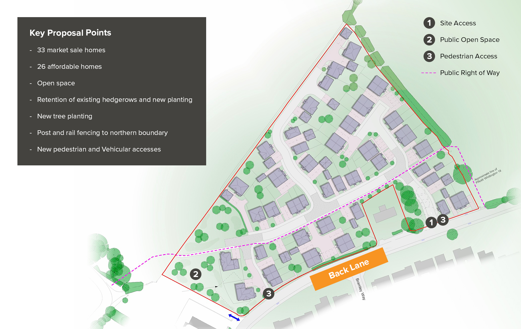
Maplevale is developing an Outline Planning Application for up to 59 new homes, with all matters of detail reserved for a later application except for access. The illustrative Site Plan identifies a mix of 26 affordable and 33 market homes for sale. Full details of the proposal will be available on the Council’s website at the point of planning validation.
Presently, the proposal seeks to deliver a mix of properties, with the mix presented in the illustrative plan as follows:
- 1 Bedroom homes: 6 total (Market 2 / Affordable 4)
- 2 Bedroom homes: 18 total (Market 10 / Affordable 8)
- 3 Bedroom homes: 24 total (Market 14 / Affordable 10)
- 4 Bedroom homes: 11 total (Market 7 / Affordable 4)
The proposal includes a strong focus on affordable housing, with an anticipated provision that will meet or exceed local planning policy requirements.
New vehicular access is proposed in a suitable location with good east-west visibility; the proposal will provide a new pedestrian footpath along Back Lane. A new pedestrian link will provide safe and convenient access into the Site.
The Public Right of Way will be retained and runs through the Site, with a clear pedestrian route proposed and presented on the Site Plan with the pink dashed line.
The proposals aim to enhance existing habitats, increase biodiversity, and deliver measurable biodiversity net gain. Ecological surveys have been informing the illustrative layout and mitigation measures, in line with planning policy requirements. The proposal will include native planting and bird/bat boxes.
A new brick wall boundary is proposed along the western extent of Back Lane, with existing hedgerows retained. Along the northern boundary of the Site, the boundary treatment is likely to be predominantly post-and-rail fencing. Existing hedgerows will be retained along the western boundary of the Site.
Flood Risk and Drainage
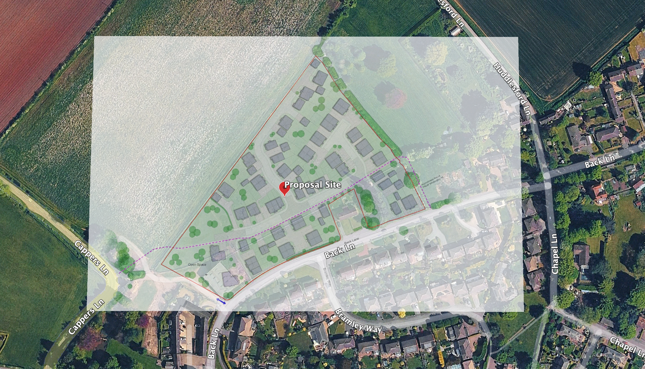
The areas shown as developable in the illustrative plan and the area of the public open space are located within Flood Zone 1, which represents the lowest probability of flooding, as defined by the Environment Agency. A drainage strategy will support the relevant planning submission and a detailed plan accompanying any ‘reserved matters’ submission.
Surface water drainage options will be reviewed in preparation of the planning submission.
Trees and Hedgerows
The proposal intends to retain trees and hedgerows, wherever possible, with new tree planting across the proposal Site.
The proposals will incorporate new and enhanced green infrastructure, including areas of public open space, native tree and shrub planting and grassland enhancements. The public open space has been located to the edge of the site, providing a natural transition to the countryside.
Ecology
Ecological surveys were undertaken in 2025 and again in 2026 to inform the emerging proposals. The surveys mapped the habitats present and assessed the potential for protected and notable species, including bats, badgers, birds, amphibians, reptiles and hedgehogs.
No statutory nature conservation sites are located within or immediately adjacent to the site. The design has been informed by the ecological assessment, with existing boundary hedgerows and a number of established trees retained wherever practicable.
The areas proposed for development are predominantly habitats of relatively low ecological value, including modified grassland. Existing hedgerows and trees provide more valuable habitat and connectivity for wildlife and have therefore been an important design consideration.
Measures will be incorporated to protect wildlife during construction and once the development is occupied. These will include appropriate timing and methods of vegetation clearance, protection of retained habitats, minimising fragmentation and enabling animals to move safely through the site and a sensitive lighting strategy around important habitat features.
Biodiversity Net Gain
The proposal will be designed to achieve the required level of Biodiversity Net Gain, subject to the outcome of a detailed assessment of the proposal.
Additional biodiversity enhancements will be incorporated into the development, such as integrated bat and bird nesting features, hedgehog access through suitable garden boundaries and wildlife-friendly planting designed to provide food and shelter for birds, bats, invertebrates and other species.
Maplevale is committed to enhancing habitats and ensuring that new developments are appropriate for biodiversity.
Highways
The site is located adjacent to an established residential community, with good opportunities for pedestrians, cyclists, and routes to the wider area.
The application proposal will be supported by a Transport Assessment. The Assessment will present the proposed development, assess the potential traffic and transport impacts, with a review of road safety and road network impacts, with a focus on accessibility for residents.
A new highway access is proposed to Back Lane, which has been designed to include a suitable width for vehicles accessing and leaving the Site.
An assessment of measured vehicle speeds has been completed, which enables an understanding of visibility from the highway junction.
Pedestrian access to the Site will be available from the new vehicle access, with pedestrian footways on either side of the proposed highway. In addition, a new pedestrian access is provided to the Church Street end of the Site, and access via the Public Right of Way is retained.
The nearest bus stop, located on Back Lane, provides links to Tamworth and Lichfield, with regular services through the day.
Electric vehicle charging infrastructure will be provided across the site to promote the use of zero or low-emission vehicles. In addition, new homes will benefit from cycle parking provision to encourage travel modes other than the private car.
Heritage
The development proposal has evolved through input by specialist Heritage Consultants. Although the Site includes no designated built assets, its boundary borders the Whittington Conservation Area.
Two Grade II listed buildings have been assessed as part of the scheme development – St Giles Church and Church Farmhouse. An assessment relating to the impact of development on the heritage assets is being finalised, with no anticipated impact relating to St Giles Church.
The Site forms part of the wider rural edge of the village and its countryside setting retains legibility of the historic farmstead context of the Whittington Conservation Area, although this contribution is limited by the surrounding suburban development.
An archaeological assessment will support the outline planning submission. The assessment identifies no designated archaeological assets (scheduled monuments, etc.) within the Site. The report confirms that development within the Site will not harm the setting or significance of any designated archaeological assets outside of the site.
Feedback
FAQs
- Is the site appropriate for residential use? The site is located adjacent to an existing residential area and within walking distance of local services and facilities. The proposed development is therefore considered suitable in principle, subject to detailed assessment through the planning process.
- How many homes will be created as a result of the scheme? Presently, the proposal has been designed to accommodate 59 new homes. Final numbers will be set out in the detailed planning submission following an outline approval.
- Will there be affordable housing? The proposal will meet or exceed the local planning authority’s affordable housing requirement, with a mix of market and affordable housing.
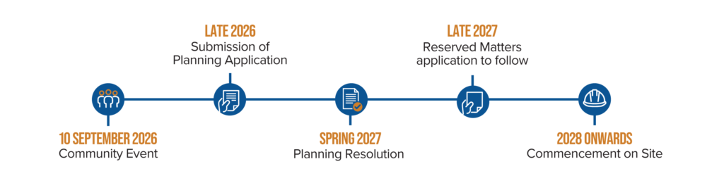
- When will a planning application be submitted? A submission is likely in early Winter 2026.
- Will the planning submission provide all the matters of detail? The application will be an outline application that focuses primarily on the principle of development. A later application with matters of detail (design, layout, landscaping, etc.) will follow approval of the outline application. The outline submission will seek approval for the site access arrangements.
- Can I submit formal comments to the local planning authority? This consultation process is different from the formal planning process, and you can continue to submit comments to the local planning authority once a planning application has been submitted.
- When will construction start? Following planning approval, a period of time will be required to develop the detailed submission. The likely construction start date will be known at the point of a detailed submission, but any Outline permission is likely to include a condition requiring an application for detailed matters within 3 years of the approval.
- What happens next? Feedback received during this consultation will help shape the final proposals before a planning application is submitted. Once submitted, the application will be subject to statutory public consultation by the local planning authority.
Timeline
Feedback
Thank you for your interest in this community consultation. To provide feedback, please click the button below. We will share all feedback received with the project team and we will not ask identifiable questions. You can submit feedback from 8 September until 23:00 on 22 September 2026.
You can provide feedback at our drop-in event at the Council Pavilion, Vicarage Lane, on 10 September from 14:30 to 18:00.
If you would like to speak to a consultation team member, please contact Holland Lloyd on 01543 713021
Feedback